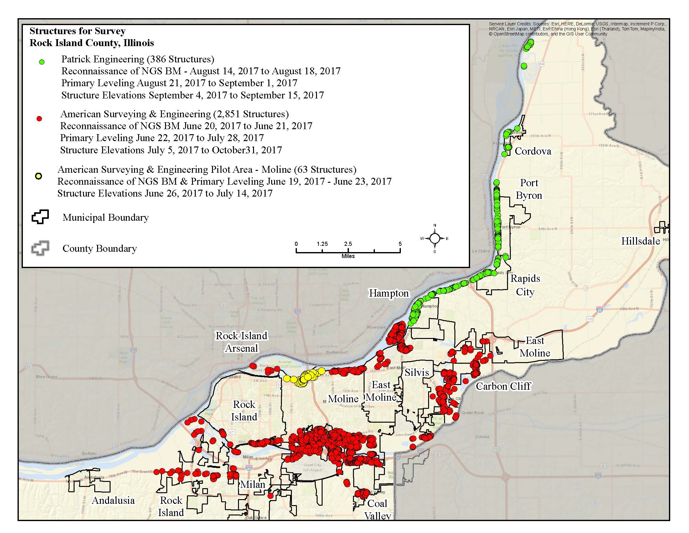
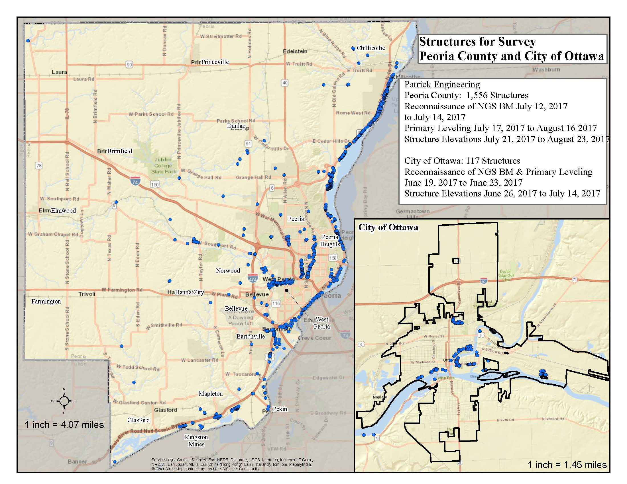
Locations of Structure-based Assessment
Structures most at risk for flooding are being surveyed within Rock Island County, Peoria County, and the City of Ottawa. This project is part of a long-term effort to create a statewide database of elevations for individual structures and flood risk in communities. The data are crucial in determining the level of risk and creating action plans to prevent flood damage to homes and businesses.
Previous ISWS projects have determined where flooding is likely to occur in communities across Illinois. However, local officials also need to know the depth of potential flooding at the property level to make informed decisions on keeping homes safe from water inundation, thereby reducing financial losses.